How do you dismantle a multibillion-dollar trafficking network when its routes are invisible?
For decades, efforts to combat the illegal wildlife trade have been primarily reactive, relying on isolated confiscations and post-crime enforcement. Here, we are shifting the paradigm from reactive enforcement to proactive, intelligence-led intervention. By integrating decades of data with advanced spatial modelling, we generate actionable intelligence to uncover the logistical backbone of the illegal parrot trade.
The Science: Predicting Trafficking Corridors
Our spatial intelligence framework combines principles from criminology with landscape ecology. Traditionally, landscape resistance models are used by ecologists to study how wild animals move through habitats. We have adapted these exact models to track the movement of traffickers.
By treating a country’s road network like an electrical grid (where roads act as conductive wires) we can calculate the “flow” of trafficked parrots from biodiverse trapping zones to urban demand centres.
Our recent application of this model in Mexico revealed:
- Shifting drivers: Over 30 years, the trade seems to have evolved from rural, poverty-driven opportunism into an organised, demand-driven enterprise.
- Predictable routes: Trafficking is not random. It concentrates along specific, high-risk corridors, providing distinct transit bottlenecks where law enforcement can strategically intervene.
- Crime convergence: Because multifaceted crime groups frequently exploit the same established routes, mapping this high-volume wildlife trade provides a powerful proxy for exposing the logistical corridors of broader, transnational organised crime.
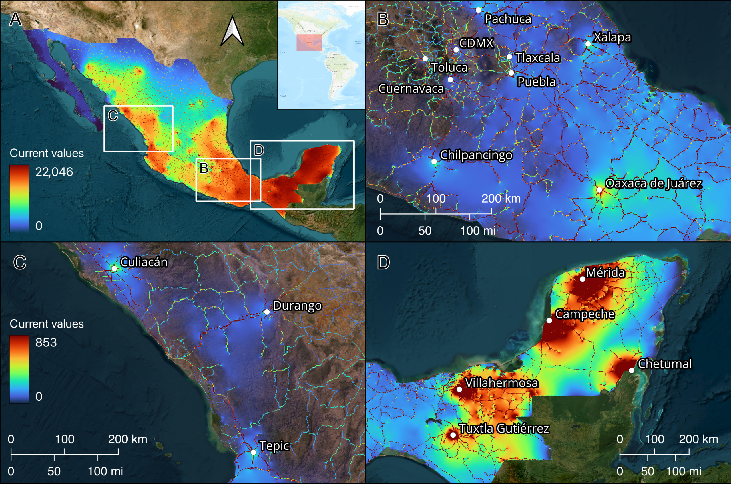
The Interactive Law Enforcement Portal
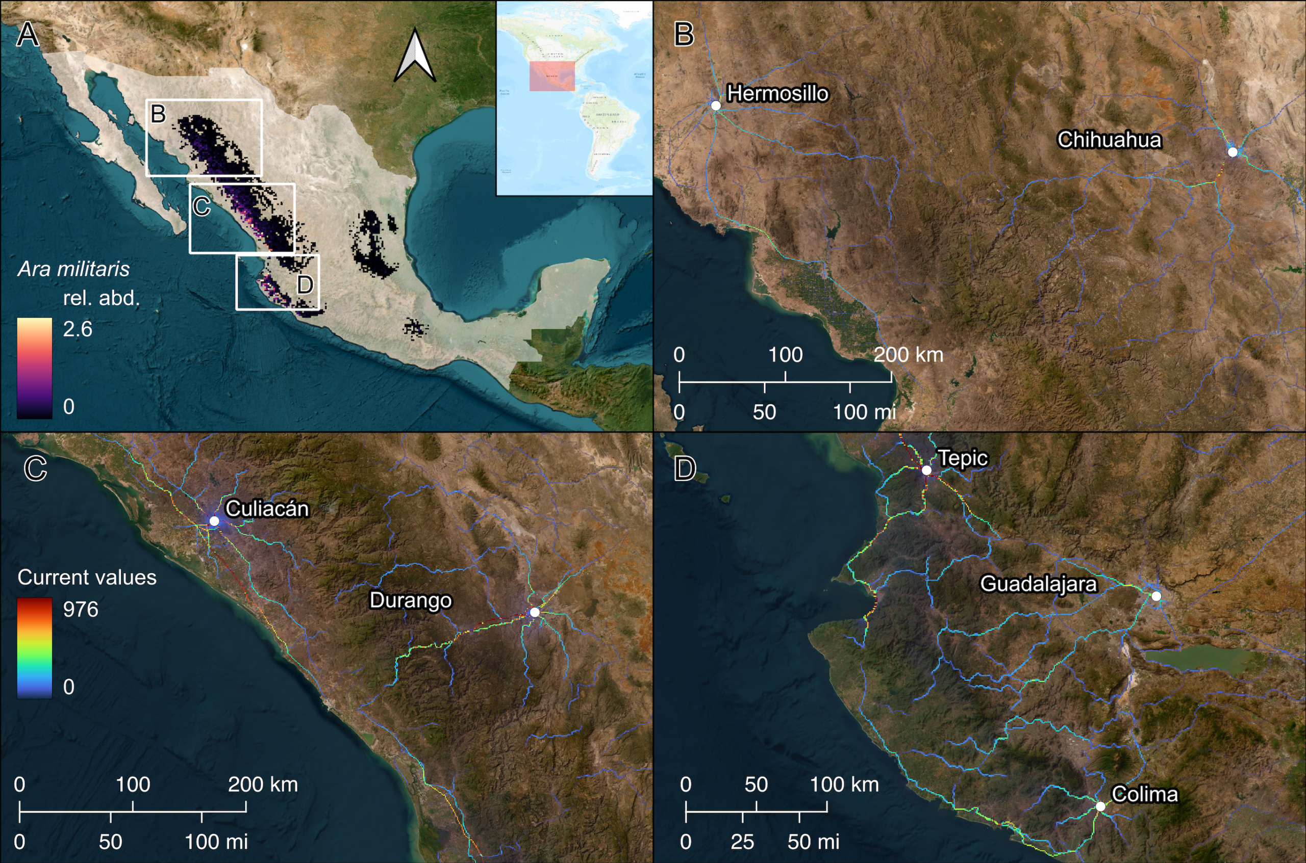
Static maps can only tell part of the story. To ensure our research translates into real-world conservation outcomes, we have developed a secure, interactive online mapping tool based on our spatial models.
Accessible exclusively to verified law enforcement and environmental authorities, this restricted portal allows officials to:
- Zoom into their specific jurisdictions.
- Inspect high-risk trafficking routes in detail.
- Filter the map by individual species (such as the Military Macaw below as an example) to focus monitoring and interdiction efforts before animals reach urban markets.
Video Abstract and Published Research
Learn more about how we tracked the evolving crisis of the Mexican parrot trade and built our spatial intelligence framework.
Our foundational study on spatial network modelling and the illegal wildlife trade was published in the Proceedings of the National Academy of Sciences (PNAS). Read the full open-access paper here.
Citation: Olah G, Léon-Pérez R, Berryman AJ, Asner G, Heinsohn R (2026) Shifting drivers and predictable corridors of an illegal wildlife trade network. PNAS 123(36):e2609240123. https://doi.org/10.1073/pnas.2609240123
This project is funded by the Australian Research Council, under a Discovery Early Career Researcher Award (DECRA project DE230100085), and hosted by the Fenner School of Environment and Society, The Australian National University.